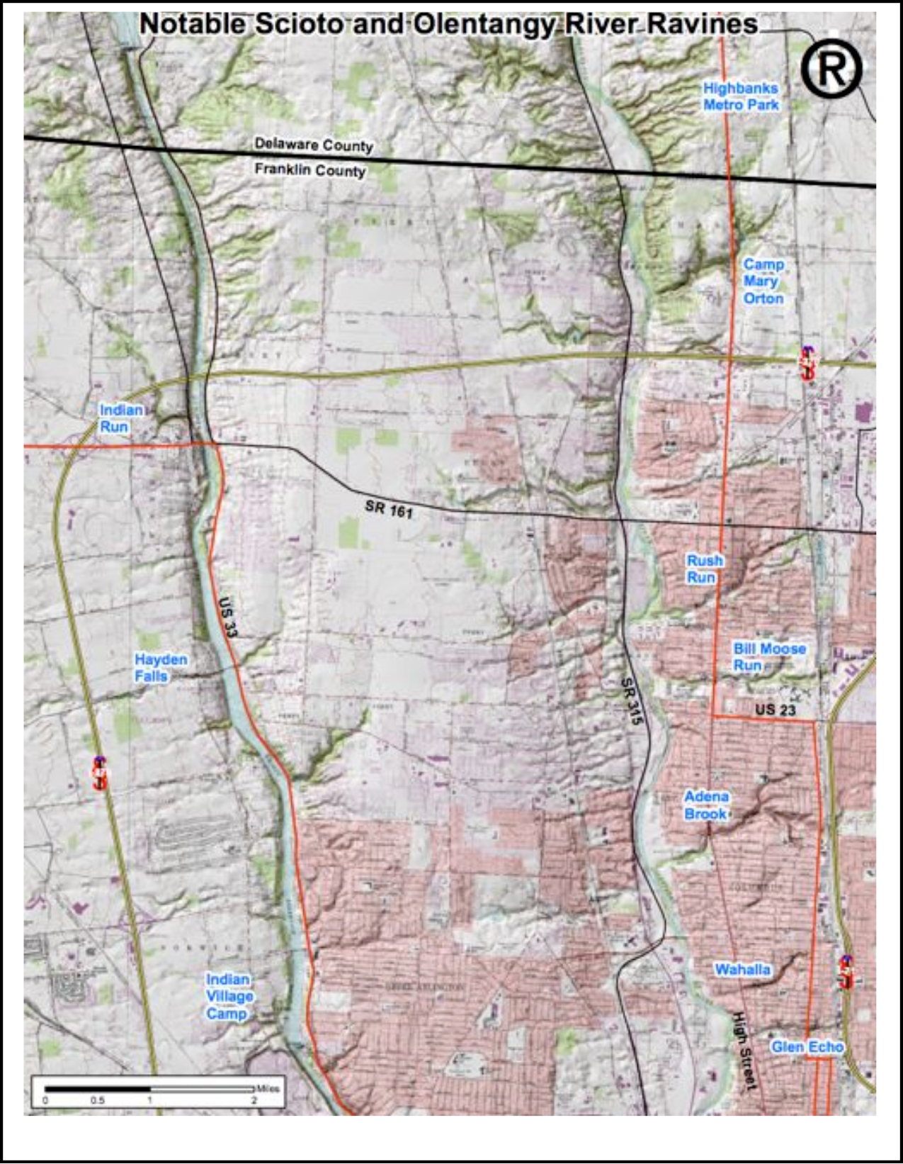
Topographic map of Notable Scioto and Olentangy Ravines (click to enlarge)
Learn more:
Bill Moose Run (photos)
• Olentangy River to N. High St.
• N. High St. to Indianola Ave.
Bill Moose Run (articles)
Ravinia, Winter 2020-21 – Bill Moose Run/Wyandot Nation Park – Help Save a Last, Pristine, Urban Ravine by Scott Williams and Stan Bialczak
Ravinia, SS 2020 – The Nature Committee at Wesley Glen Loves Bill Moose Run! by Maureen Lorenz
Ravinia, Fall05/Winter06 – Spring Ephemerals in Bill Moose Ravine
Ravinia, Fall02 – Bill Moose Run, An Urban Treasure & Bill Moose and My Grandfather Ranall, by Greta Adams
Beechwold Nature Preserve (not shown above) –
Articles
Ravinia, SS 2013 – Beechwold the Beautiful, by Gregg Peace
Ravinia, Fall08/Winter09 – Beechwold Park Residents Battle Bush Honeysuckle, by Todd Lusch
Articles
Ravinia, SS 2020 – Violent Storms Damage Glen Echo and Walhalla Ravines by Martha Harter Buckalew; A Walk Along Walhalla Ravine by Martha Harter Buckalew
Ravina, Fall 2016/Winter 2017 – Friends of the Ravines Plank Walk Walhalla Ravine
Ravinia, SS 2011 – Walhalla Ravine Wildlife Habitat Restoration Project, by Dianne Blankenbaker
Ravinia, SS 2003 – The Summer House on Walhalla
Ravines Quarterly Winter 1997 – Walhalla Ravine Study the Focus of OSU Class, by Shelly Keith
Ravines Quarterly Fall 1996 – The Legend of Walhalla Ravine, by Jim Scarff
Rush Run
Articles
Ravinia, SS 2020 – The Rush Run Landscape in Spring

